

The journey from Kalupahana to Ohiya is an adventure You could be tough enough to walk its length or mad enough to drive the ruined road but this is a journey worth taking for the experience of rugged Sri Lanka
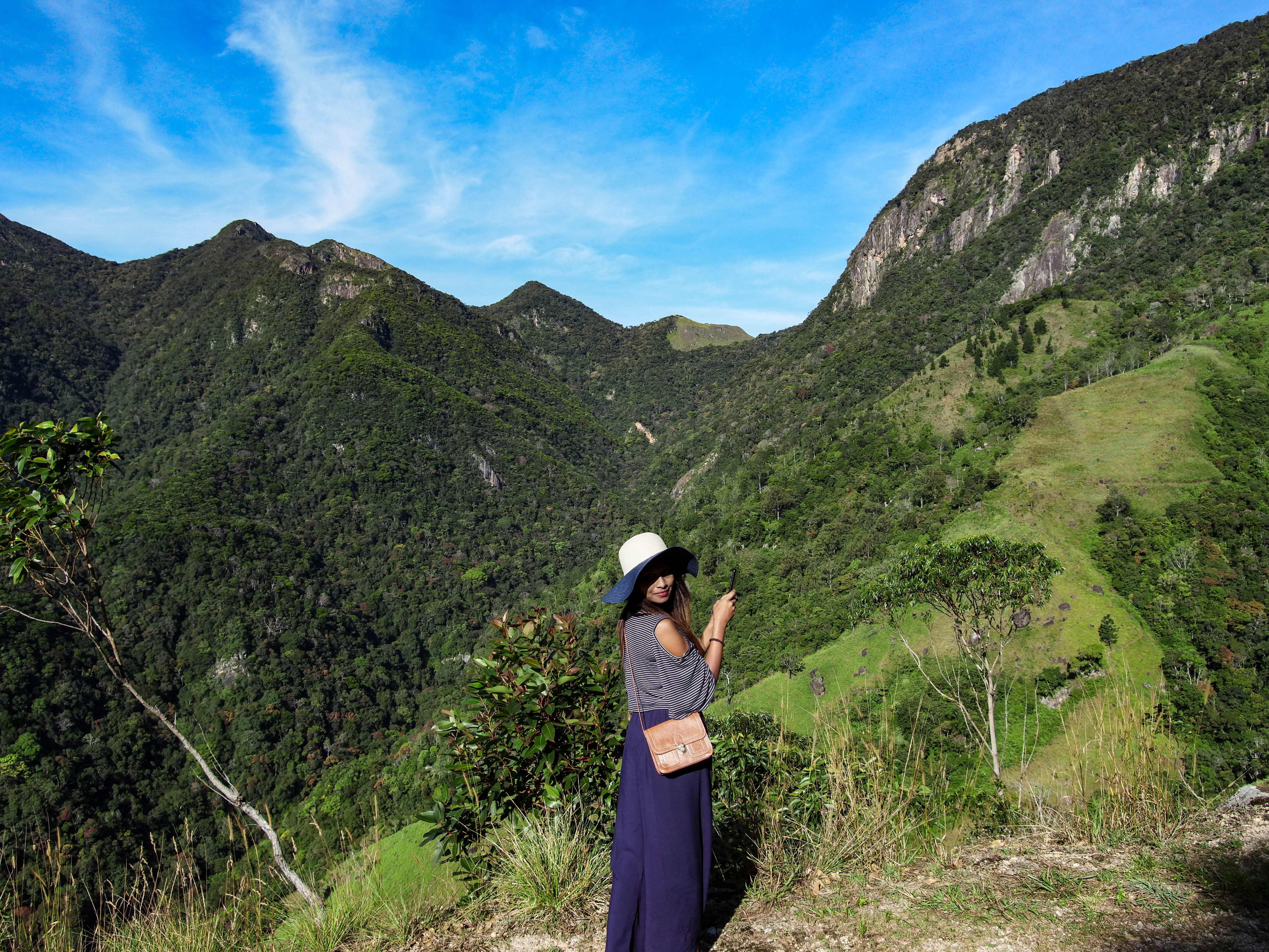
Bordering the Horton Plains National Park the 16km road that connects Kalupahana in the Central Highlands to the Ohiya-Horton Plains Road path may appear harmless on Google maps.
The once steep climb on some wet, and slippery stone assembled stairs that lead to the Bag (Sack) Collection peak at the now called V-Cut point by a cable was called the Devil’s Stairs by the tea estate workers for its tough nature. This is said to have got worse with rains and mist.
Now it’s a challenging 4 to 5ft-wide motorable path accessible by 4×4 vehicle, with narrow twisty bends, unforgiving roads: a steep hill climb of 1,200m through unpopulated areas, waterfalls, streams, broken bridges, abandoned tea estates and factories.
We were told stories about how the entire area was a flourishing tea estate during the British era and now is abanded. The trekking paths were made by the British to travel by horseback.
Getting there
There are different ways to experience Devil’s Staircase in Sri Lanka depending on time, mode of transport and physical fitness. The hardcore way is to climb it from Kalupahana and exit in Ohiya which would take eight to nine hours. The other option is to walk down from Ohiya to Kalupahana which would take five to six hours. However, both journeys are not to be taken lightly.
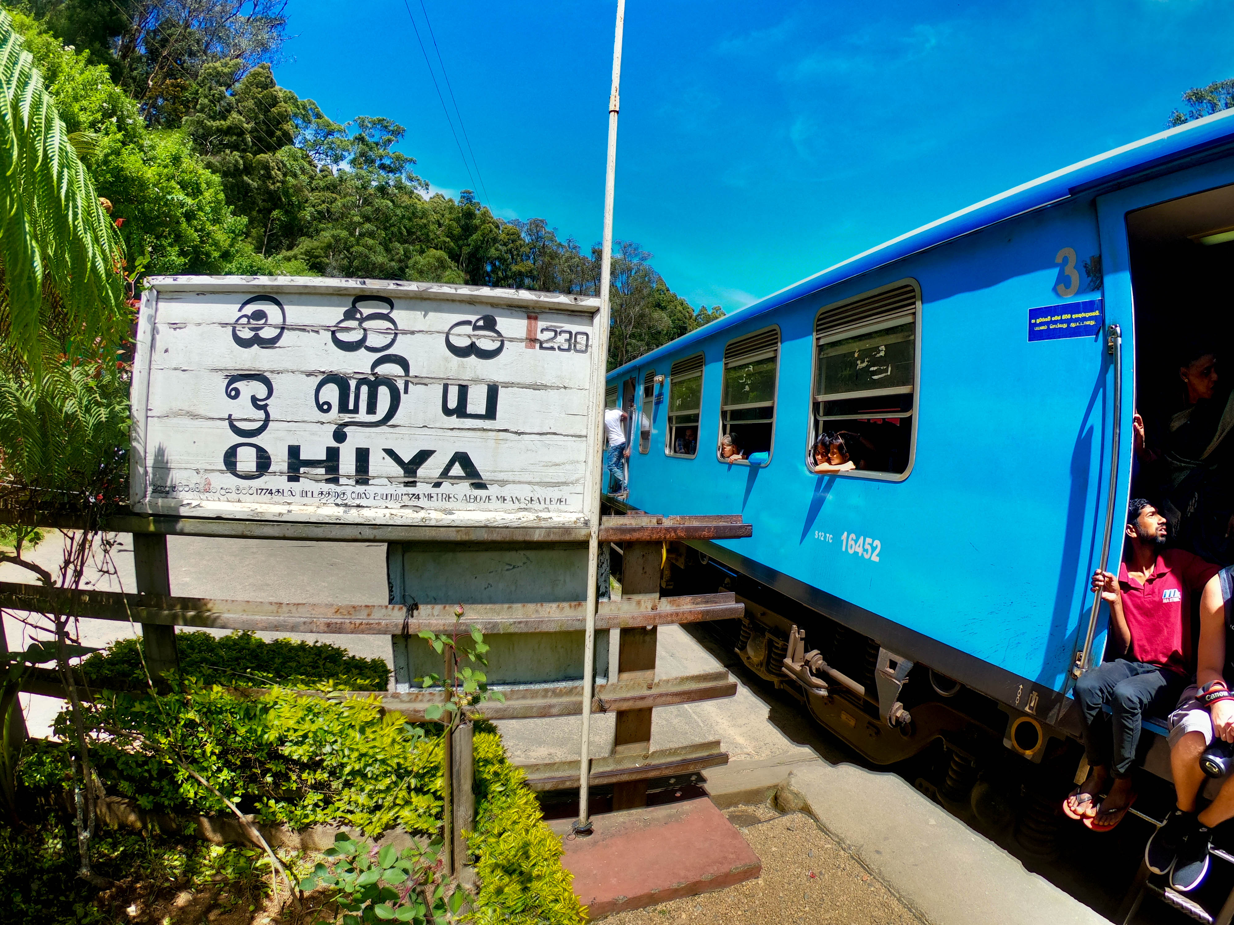
The nearest railway station is at Ohiya. The Badulla Night Mail train leaves at 8 PM from Colombo Fort Railway Station. The journey to Ohiya takes nine hours with the train scheduled to arrive at Ohiya Station around five in the morning. Although you miss the scenery, travelling by night enables you to start the trek early in the morning. The mornings are usually fairly cold (15 to 20 °C).
Another way is to travel by bus ( Bus Number 99 Colombo-Badulla). You can get off at Kalupahana. Both Kalupahana and Ohiya have accommodation and shops which sell food with okayish toilets.
Accommodation at Ohiya
Kalupahana – Ohiya to Idalgashina by train and back to Kalupahana
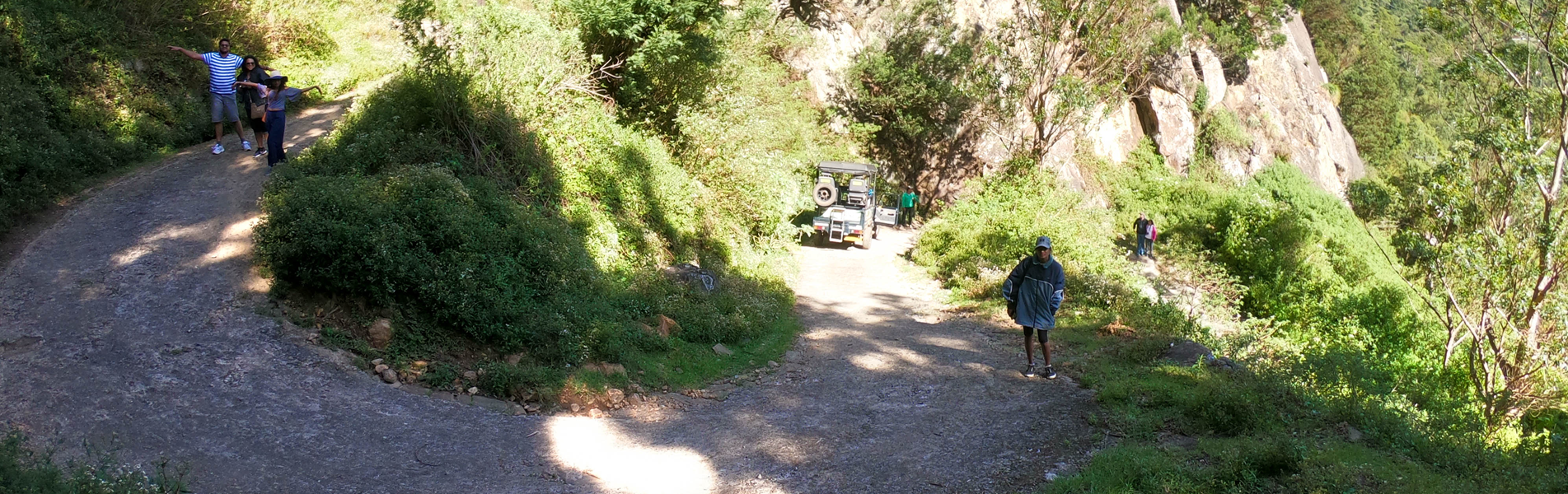
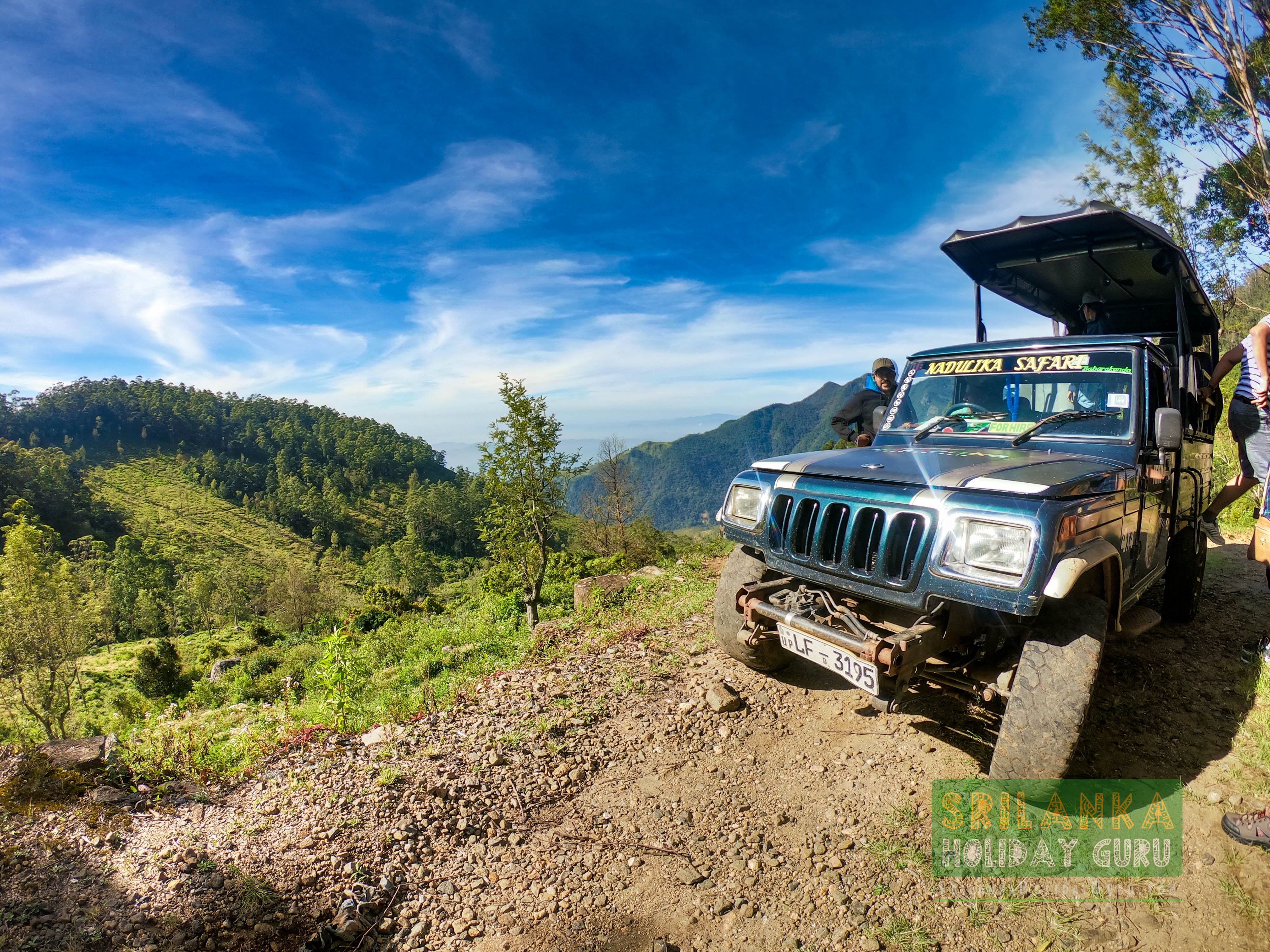
We decided not to trek but to hire an eight-seater 4×4 vehicle from Nadunika Safari (+94 713 450 633). Kasun Madawa, our driver and guide, met us at 6.30am at Kalupahana junction to take us for the expedition.
The first part of the trail is a well-paved road leading from the Kalupahana junction to a little beyond the Bambarakanda waterfall.
Kalupahana to Bambarakanda Waterfalls
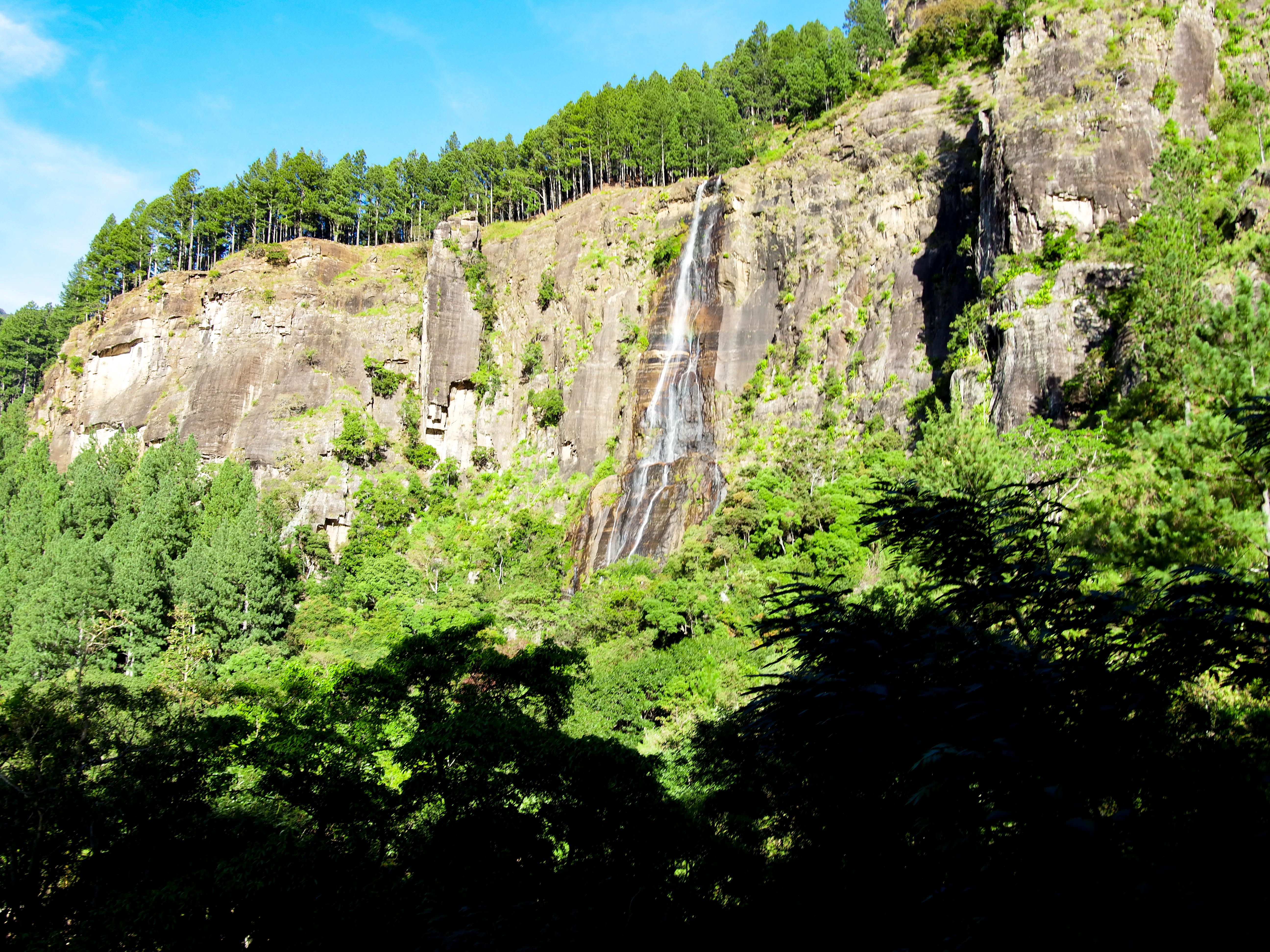
At 790 metres, the Bambarakanda waterfall is the highest in Sri Lanka and is the 299th tallest waterfall in the world. Access to the falls is not direct from the roadside and some walking is required. It’s a perfect spot to bathe but be warned of the freezing cold water and leaches.
The best times to view the falls are in March and April; however, you can see Bambarakanda in all its glory after any heavy rainfall. We were told that hiking to the peak of the waterfall is possible.
There’s a camping spot of the mountains overlooking the Bambarakanda waterfalls. The area is surrounded by Uva, Central and Sabaragamuwa provinces.
On clear days, you can catch a glint of the sea, and if you’re lucky enough to be camping up here on a clear night, watch for the flash of the lighthouse at Dondra Head, the southernmost point of Sri Lanka.
From this point, we were able to see other waterfalls like Bata Ella, Lanka Ella, Yahalathenna Waterfall, Bata Ella. (Ella is a Sinhala word referring to a waterfall)
Top of Bambarakanda Falls
We forded a stream that runs across the road, this is the stream that eventually flows down and becomes the Bambarakanda waterfall.
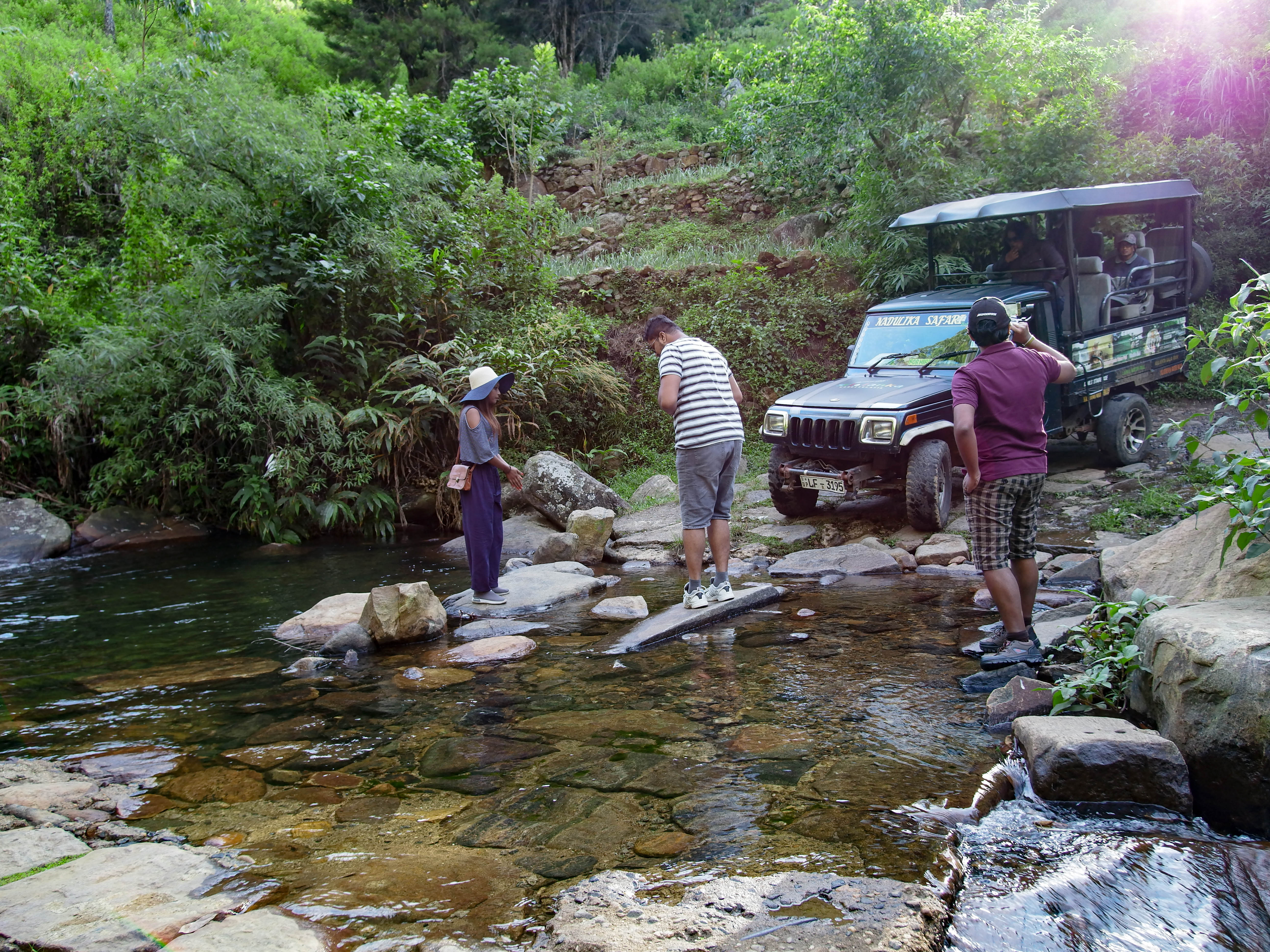
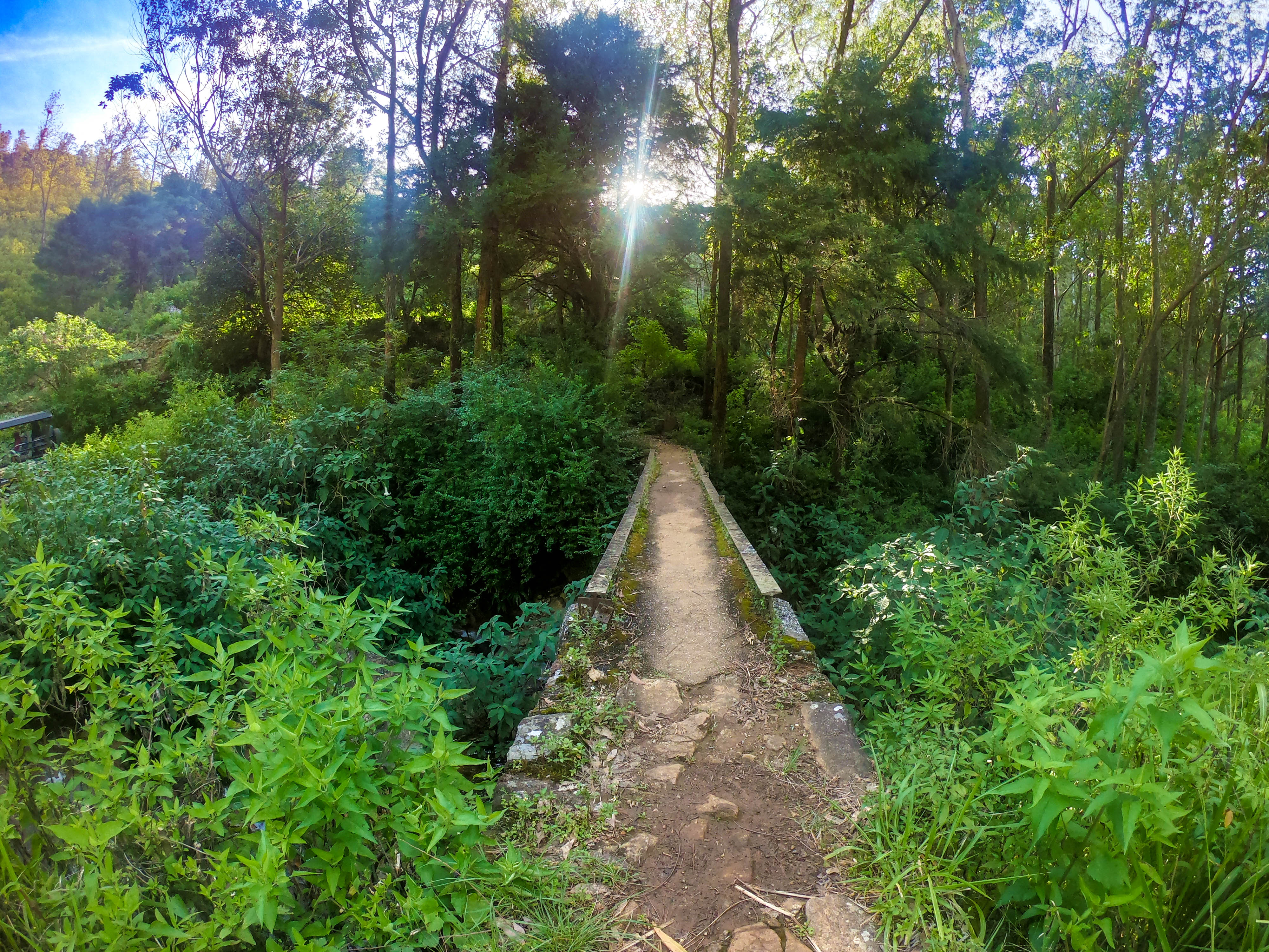
The volume of water was low and our 4×4 vehicle was able to drive through. There’s a narrow metal bridge to go over the stream which is used when the water flow is high during the monsoon season.
After passing the stream, the trail was full of sharp bends, and we were ascending on the side of a mountain crested with unmaintained tea plants.
Bambarakanda stream to V-cut
After the 2-3km drive, the road travels through a man-split mountain, known as the V-Cut.
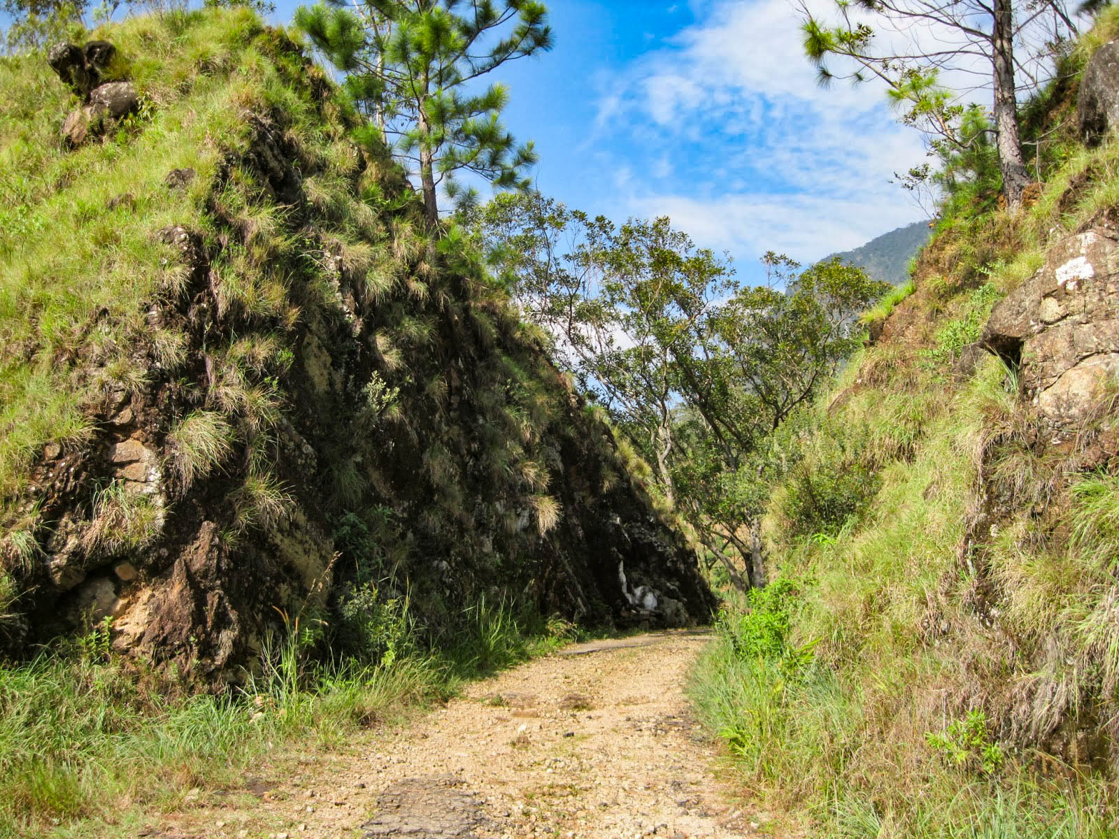
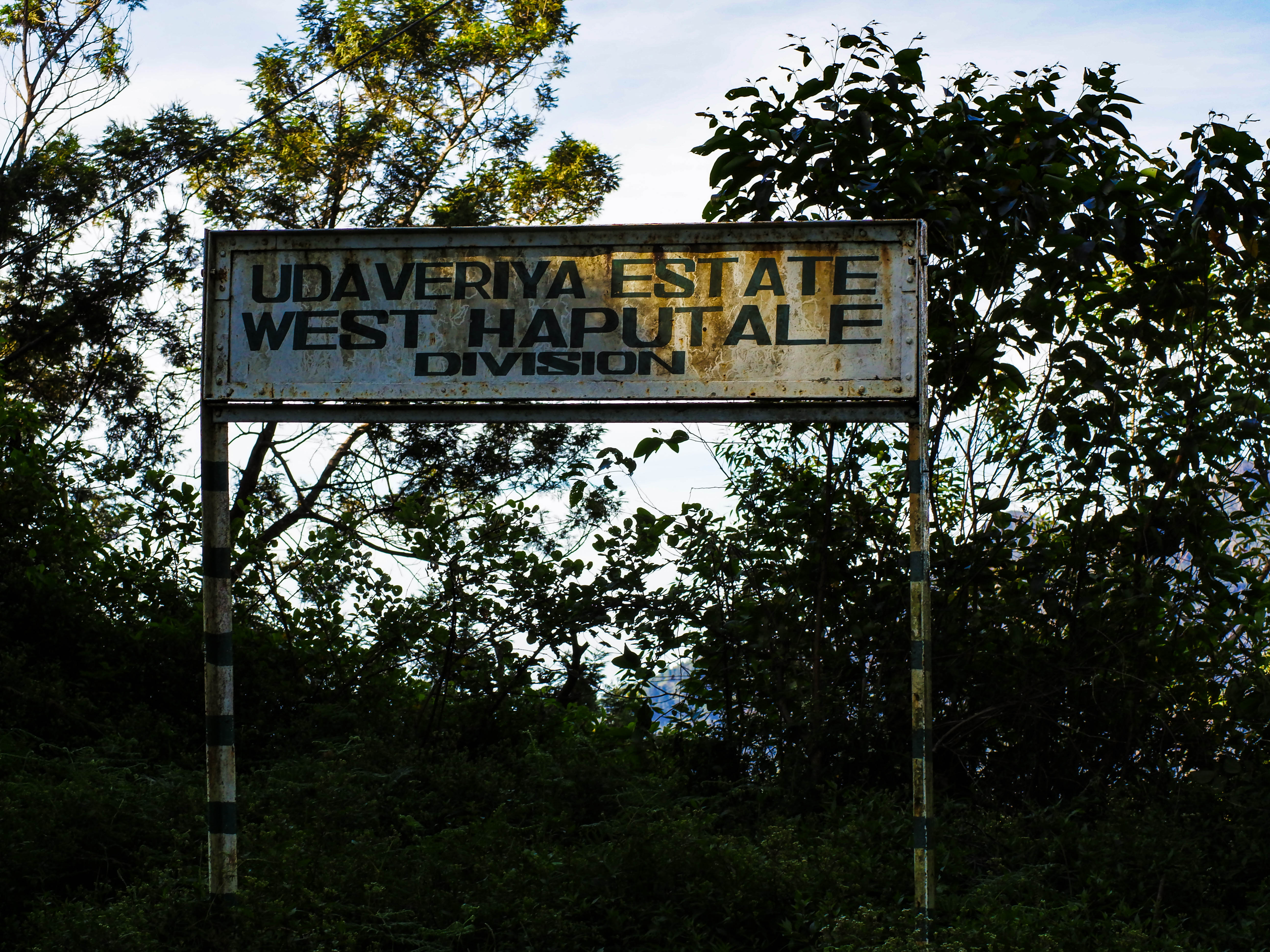
One side of the V-Cut was windy (Bambarakanda to V-Cut), while the other side was very calm (from V-Cut to Udaveriya Estate).
The historical importance of this area is that when the tea estates were run by the British, sacks of plucked tea were sent to this spot for collection via an overhead cable from the Udaveriya Estates.
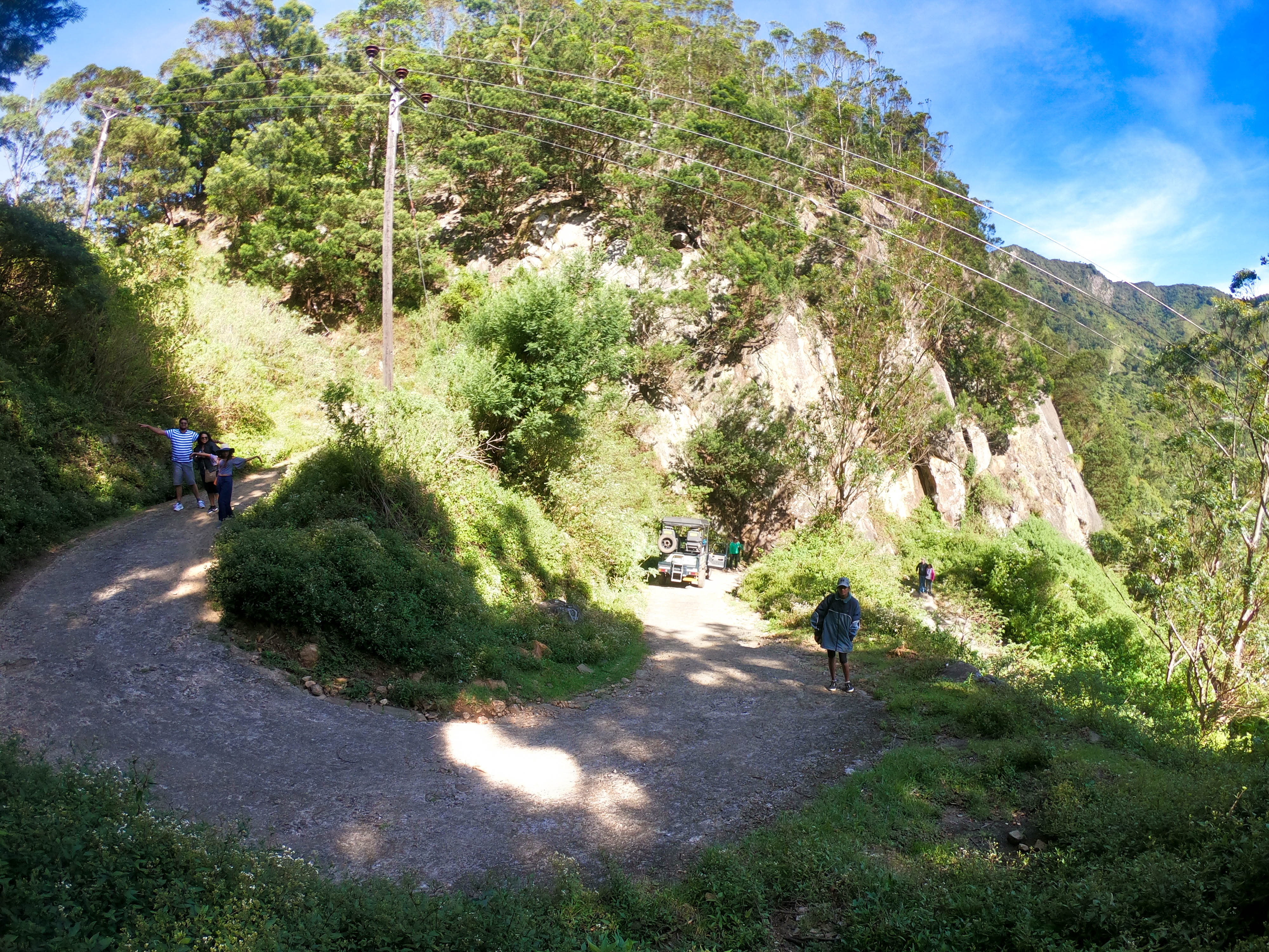
Udaveriya estate to Devil’s staircase
The weather was clear allowing us to take enough photographs and the dryness kept the leaches away. It is a challenging route which requires a reliable vehicle with good off-road capability and tires. The track has some hair-raising switchbacks.
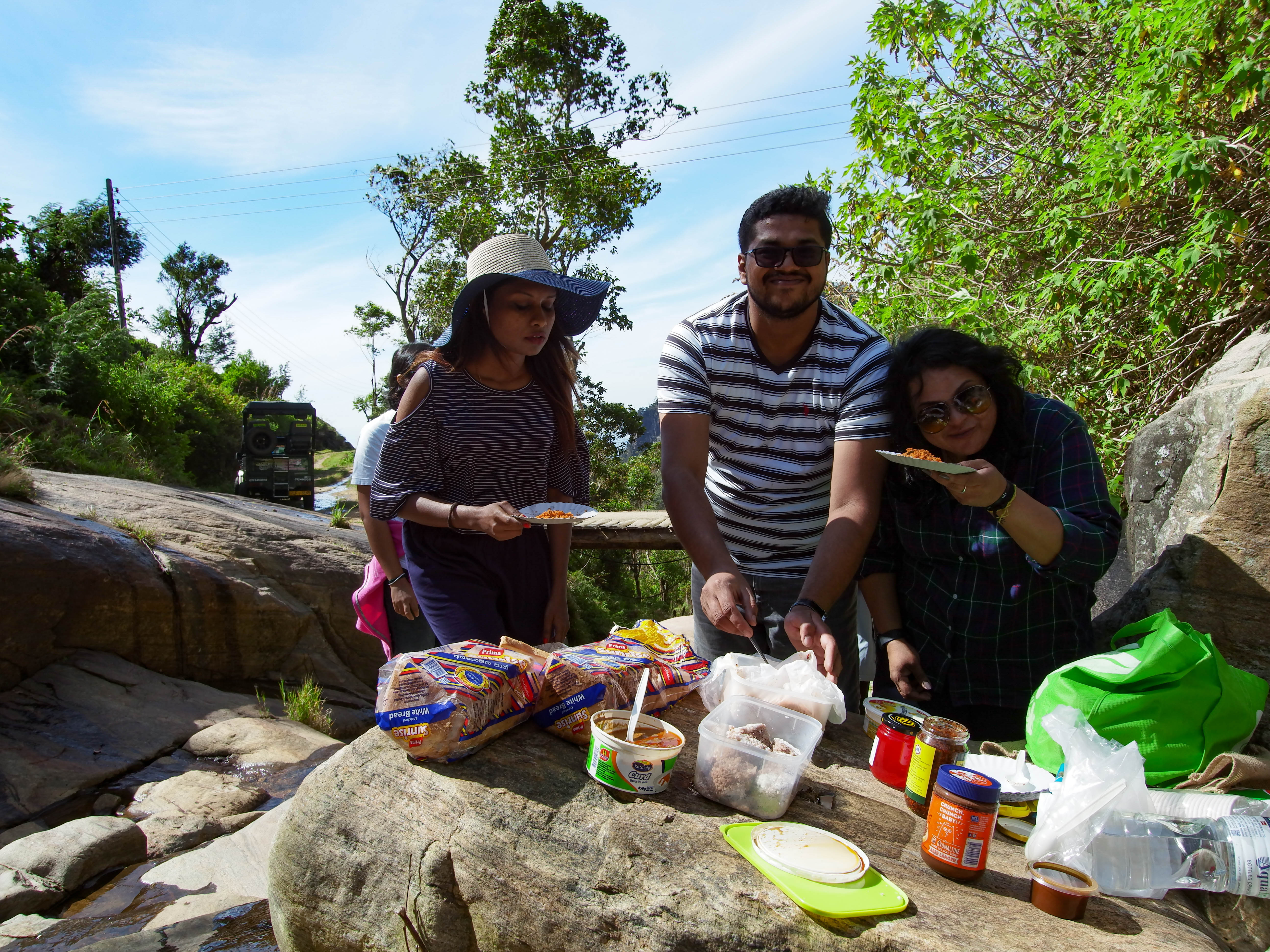
Weli Oya (River)
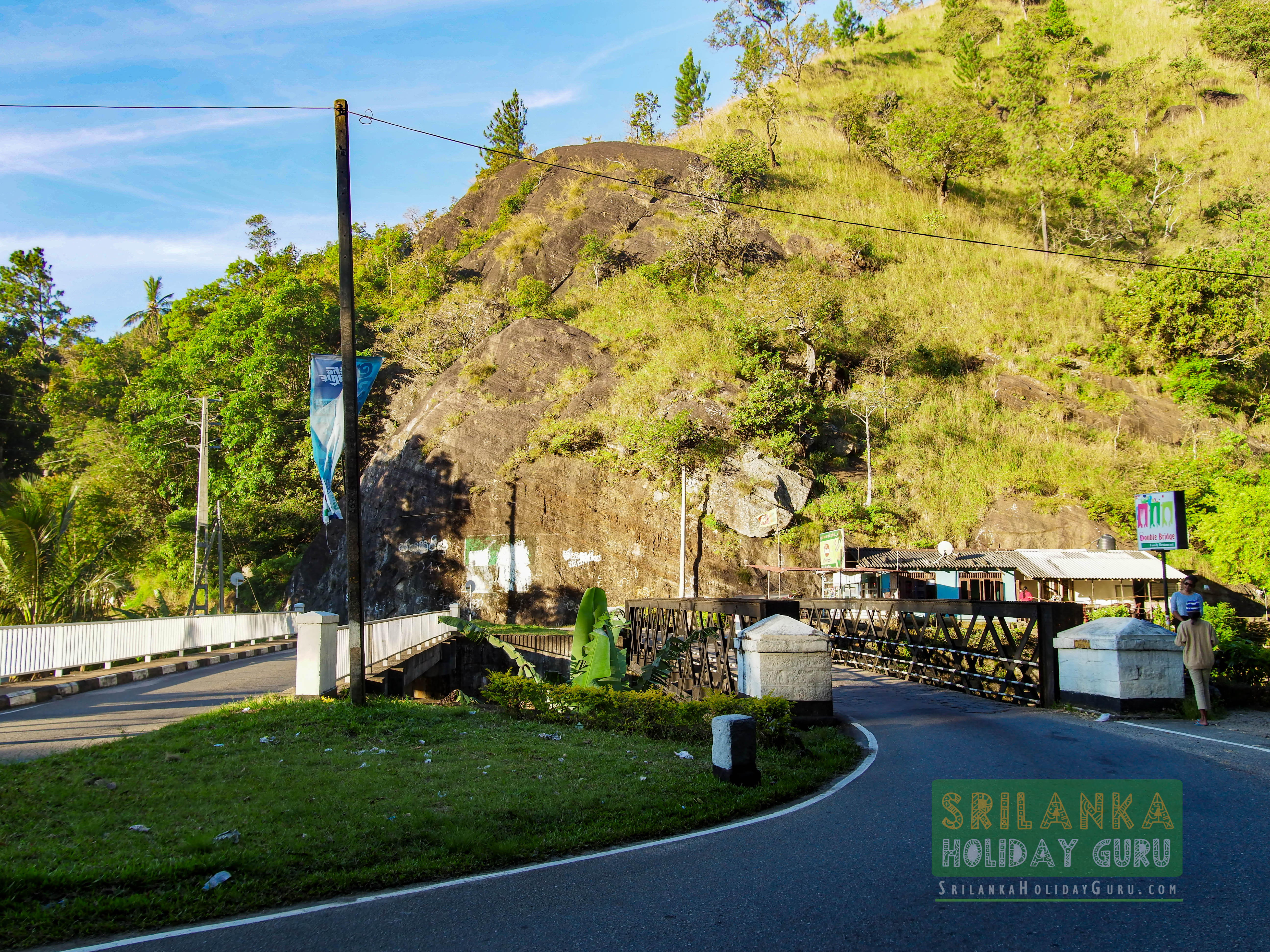
A few metres from the Devil’s Staircase we came across the beginning of the Weli Oya (River) which flows down all the way to the double bridge on the Colombo – Badulla main road. The water was perfect hence we decided to stop for a picnic meal there.
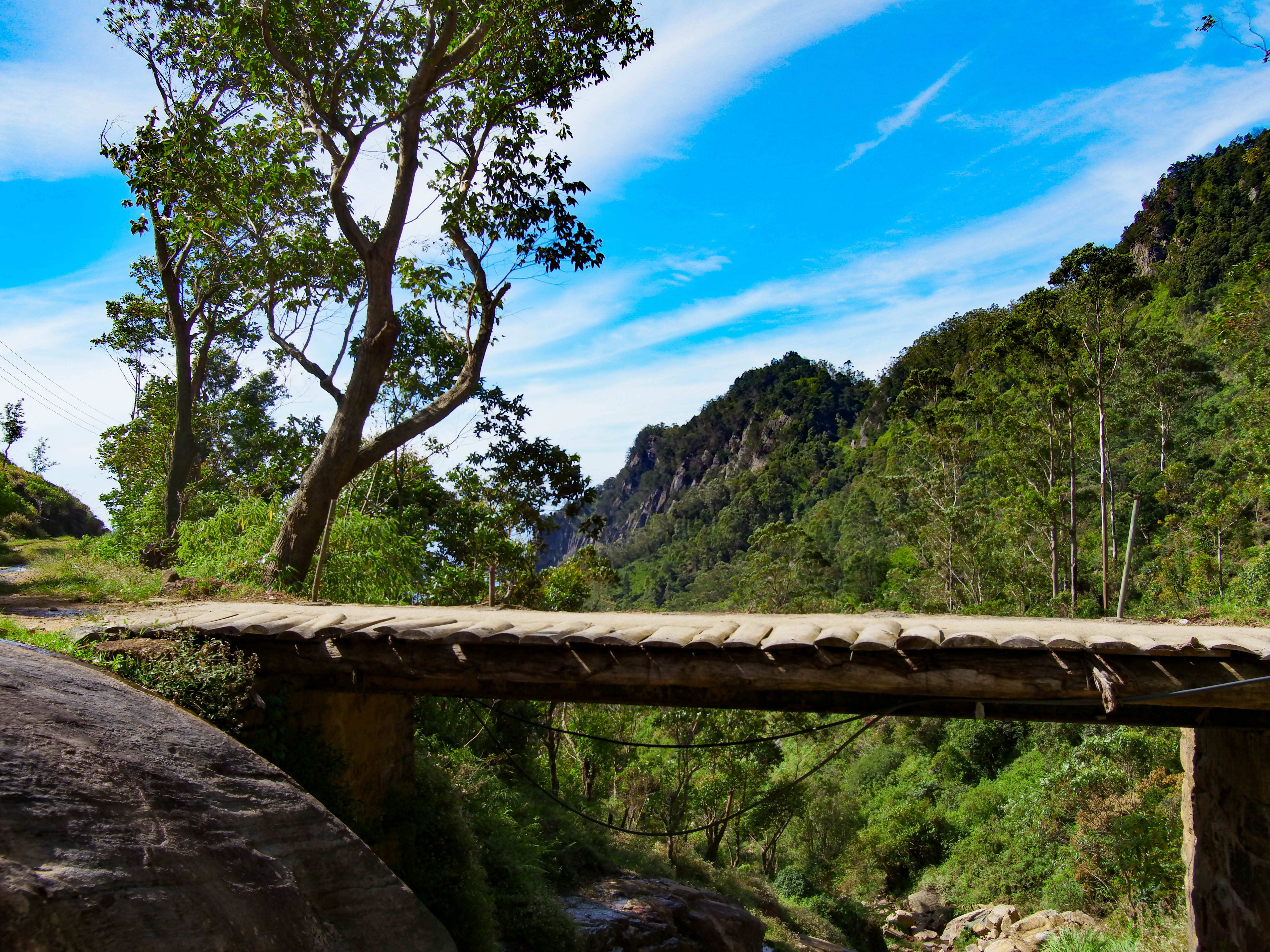
Most of the bridges are broken and cannot take the weight of a vehicle and the people in it. When we came to such a bridge Kasun would ask us to get down and walk across.
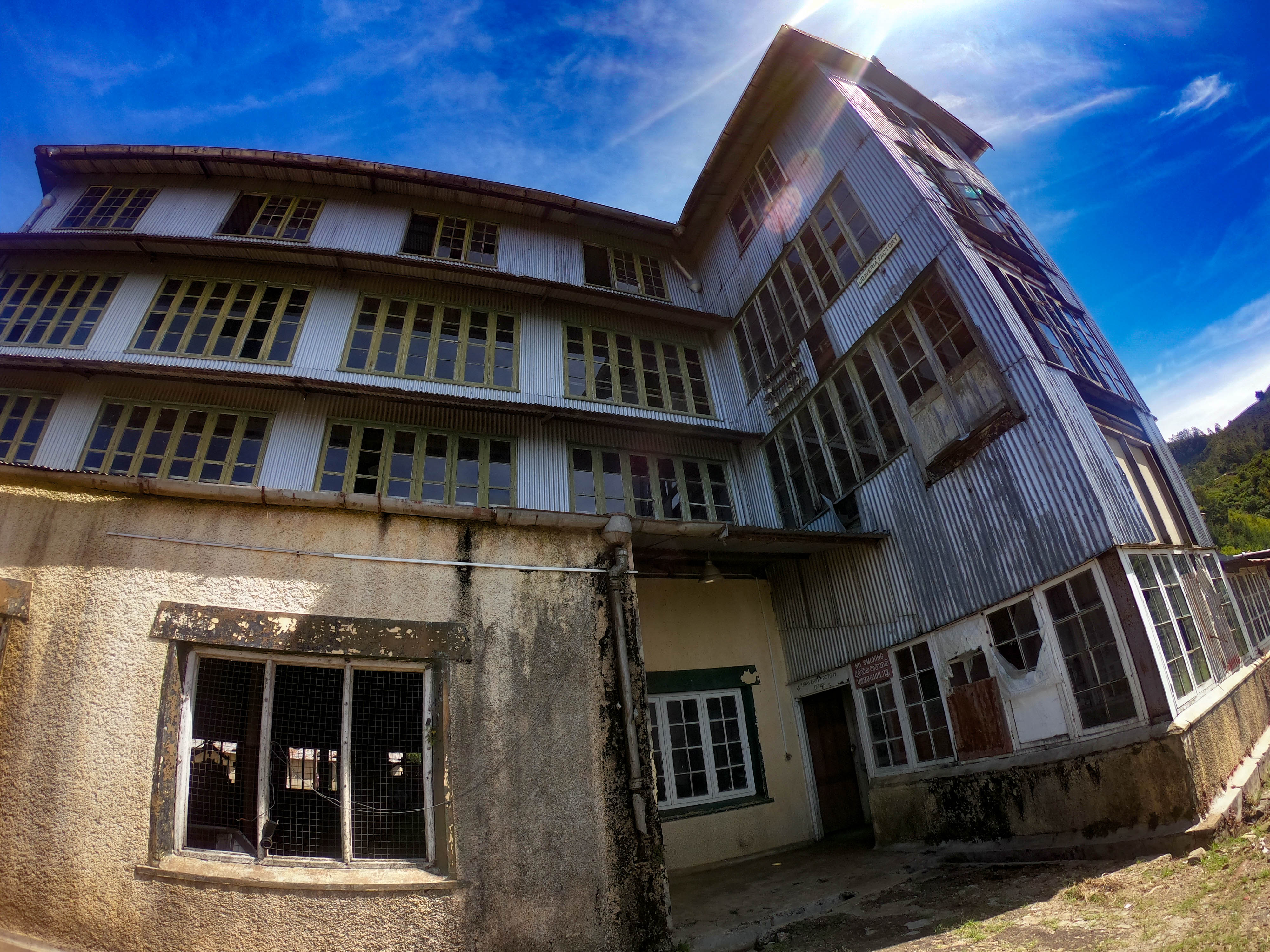
Udaweriya Tea Factory.
Moving on from our picnic spot at the Weli Oya we came across one of the many abandoned tea factories in the area. Depending who’s on duty you might, might not, be allowed to go inside. Most of these are private estates, leased from the government.

The train journey
Driving from the abandoned Udaweriya Tea factory we headed to Ohiya railway station for the 13.30 train journey. Kasun dropped us there to drive to Idalgashina station to meet us.
The train was packed with locals and tourists but that didn’t stop us enjoying the spectacular scenery. There were, stunning views to the southwest over the lowland plains of Sri Lanka. The Haputale Range is on the southern edge of the Central Highlands, and the slopes drop thousands of metres down. This is a train journey that’s unforgettable and we recommend it as a way to see Sri Lanka’s rugged beauty.
Idalgashina 5,299 ft, (1,615m) above sea level is located in the Haputale-Namunukula mountain range. The closest large town is Haputale.
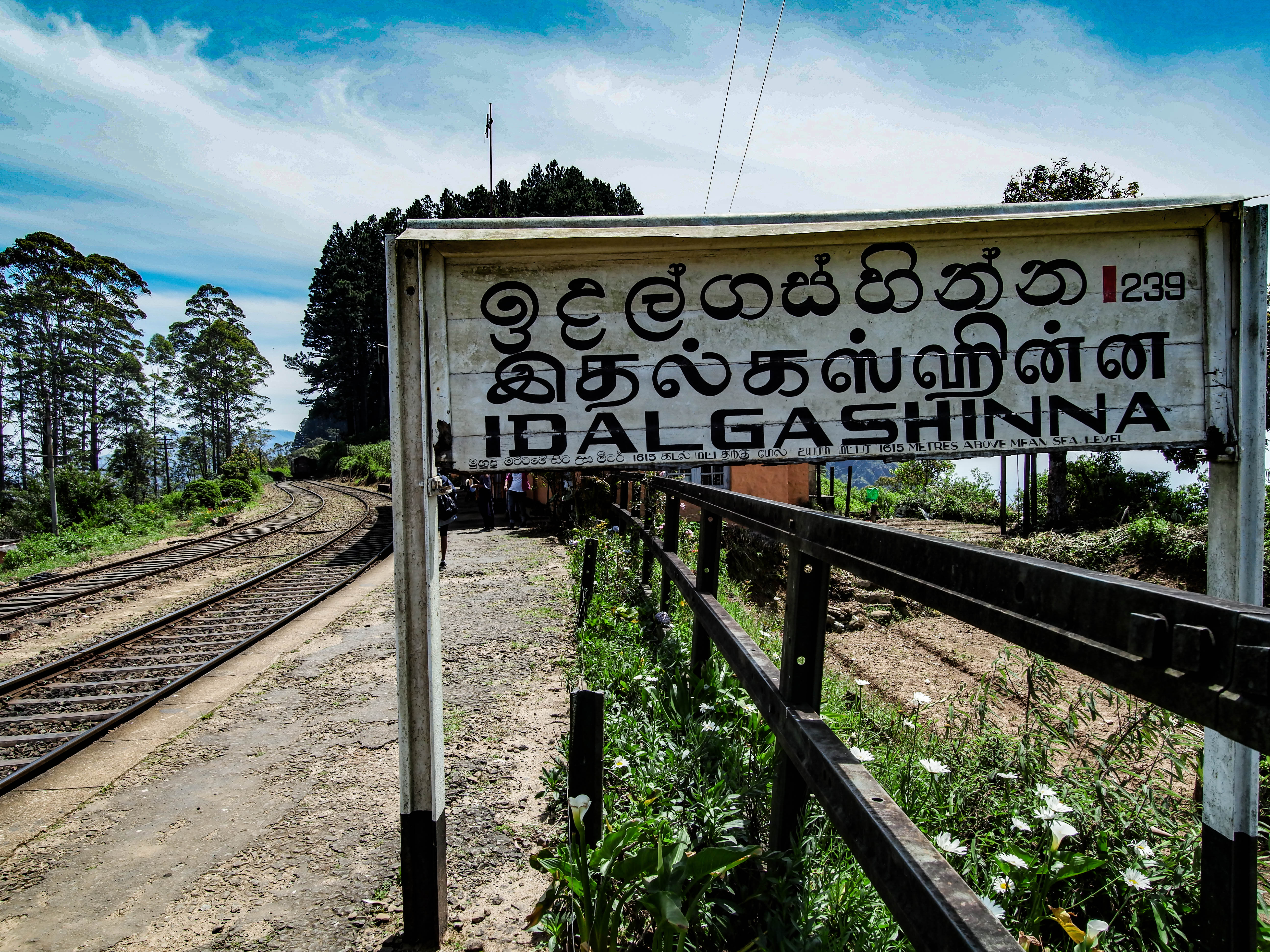
Five provinces, Eastern, Southern, Central, sabaragamuwa and Uva could be seen from Idalgashina and its train station.
Idalgashinna Pass is a prominent geological feature in the area; Idalgashinna was regarded as a key entrance to the upland country, with the Portuguese attempting to use the pass in their wars against the Kingdom of Kandy in the 16th century.
The train was actually faster than our slow 4X4 vehicle, so we had plenty of time to spend and walk around to explore the area while we waited to be picked up.
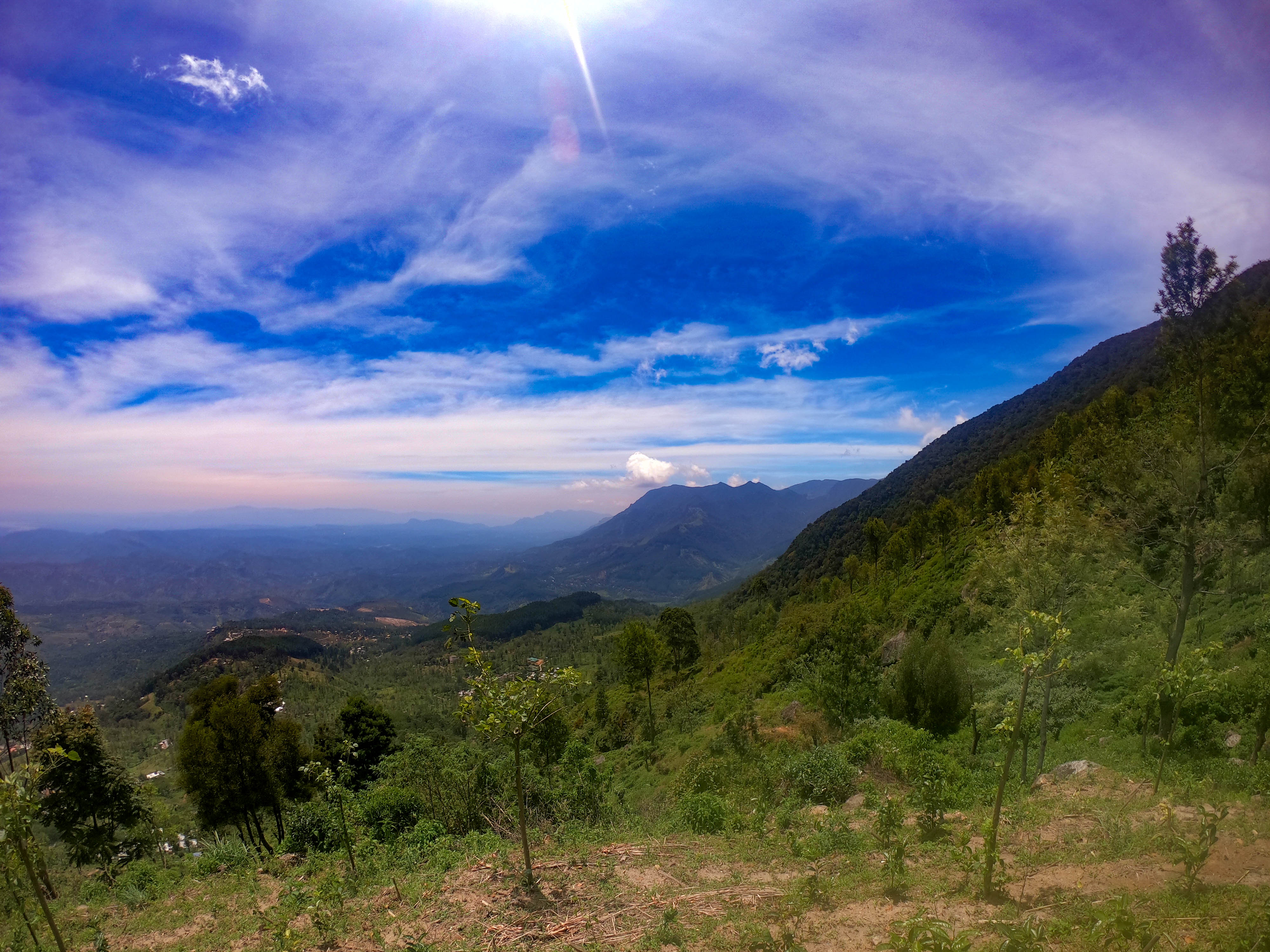
Viewpoint Idalgashina
After meeting our vehicle, a few metres from the Idalgashina railway station we stopped at a place named The Idalgashina viewpoint. We could see the five provinces and itheir landmarks clearly. The weather was perfect with a slight chill.
Driving from Idalgashina on the main Colombo – Badulla road we were dropped back at our pickup point, Kalupahana, which also ended our trail with Kasun.
If hiking is your thing, The Devil’s Staircase Is probably the most enjoyable and possibly the most challenging, road hike in Sri Lanka. For 4×4 enthusiasts, mountain bikers, or off-the-road motorcyclists, this is a trail worthy of any bucket list.
Our Map
Sri Lanka Holiday Guru Tips
- Travel in groups or with at least with one companion. Not recommended for a solo hike. If solo, hire Kasun and his 4×4 vehicle.
- Take a very good rest if you’re on foot
- Carry enough snacks like biscuits, sweets, and some drinks as there aren’t any shops on the trek.
- Greet people you meet on the way with a smile but avoid lengthy conversations or giving gifts. Of course, ask for directions if you get lost.
- Take good care of your personal belongings. Carry a medical kit in case of an emergency.
- Mobile phones and GPS might not work along most of the trek.
- You can easily get lost so plan the paths well. Take a physical map or print outs if needed.
- Avoid climbing wet rocks and pine forests.
- Make sure you wear decent walking shoes as the trail is rough.
- Wear comfortable clothing
- Leaches and other insects could be a problem.. ( Keep leaches out by applying soap, or you could use a strong insect replant)
- Be prepared for dramatic weather changes. A raincoat would be useful.