Royston Reports, Newsletter No. 12
Greetings.
Does anyone know the name for a person who collects antique maps?
That’s what I am. I collect antique maps of Sri Lanka, or I should say Ceylon since that’s the name (or a version of it) appearing on old maps of the island.
One of the first maps on which Sri Lanka is identifiable is as part of Asia was scratched onto a wooden block used for printing, by German cartographer, Sebastian Munster (1488-1552) and printed in 1550. Etching on copper and steel plates improved the quality of printing, but not necessarily the accuracy since a map in centuries past was based on reports of ancient mariners.
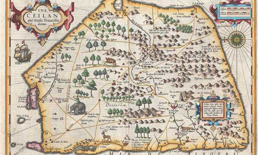
One of the most attractive of the antique maps of Sri Lanka is by Mercator and Hondius. Printed in 1609. It shows Sri Lanka lying on its side, oriented from the east and depicts the entire island in great detail. Forests and mountains cover the island and several different animals are illustrated including a stag and an elephant ridden by a man.
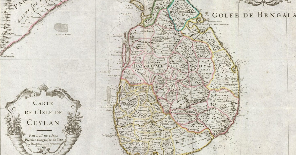
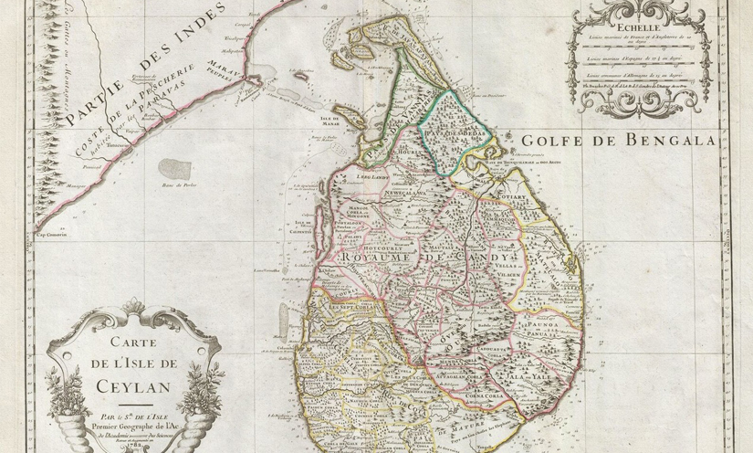
A map created in 1782 by Guillaume de L’Isle also shows Sri Lanka in its entirety with details of villages and towns. At the time it was first printed, the British captured (from the Dutch) the port and fort of Trincomalee, which lead to British occupation from 1796 to 1948.
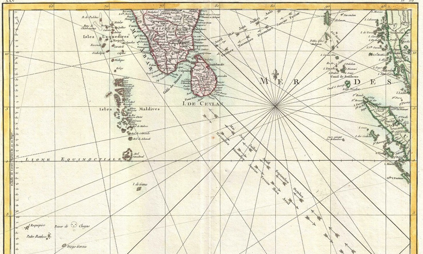
A delightful map by Rigobert Bonne, dated 1770, shows Sri Lanka’s importance as a port of call on the Spice Route, with the Trade Winds clearly depicted by arrows. This is relevant even today as it reflects the monsoon winds which bring rain to the west coast from April to November, and to the east coast from December to March, establishing the coastal holiday seasons for sun-seeking tourists.
While some antique maps of Sri Lanka that come on to the market, have been hand-coloured, this would have been done at a later date, after they were printed. Although the colouring adds attractiveness, serious collectors prefer maps as they were published, uncoloured on old parchment paper that smells of centuries past.
These ancient maps of Sri Lanka can still be found for sale in antique map dealers’ stores in Europe (and on internet auctions) but not in Sri Lanka. The climate and insects combine to destroy old documents, books and maps here, so if you want an antique map of Sri Lanka as a souvenir of your stay, you may need to look in your home country. It’s a good investment (probably starting at US$100) since prices increase each year, as the maps become harder to find.
Happy holiday.
Royston Ellis
Editorial Consultant, Sri Lanka Holiday Guru
Subscribe to our newsletter to get our newest articles instantly!


